On September 1, 2019 Hurricane Dorian slammed the Bahamas with its devastating category five, 185 mph winds, 225 gusts and 23-foot storm surge. Its first target was the chain of small Abaco Cays.
The Abacos are home to some of the oldest settlements in the Bahamas, dating from the late 1700’s by Loyalists who fled the American Revolution and took their slaves with them to work their new plantations in the islands. The main islands of Great Abaco and Little Abaco are 180 miles from the coast of Florida and lie just east of Grand Bahama island.
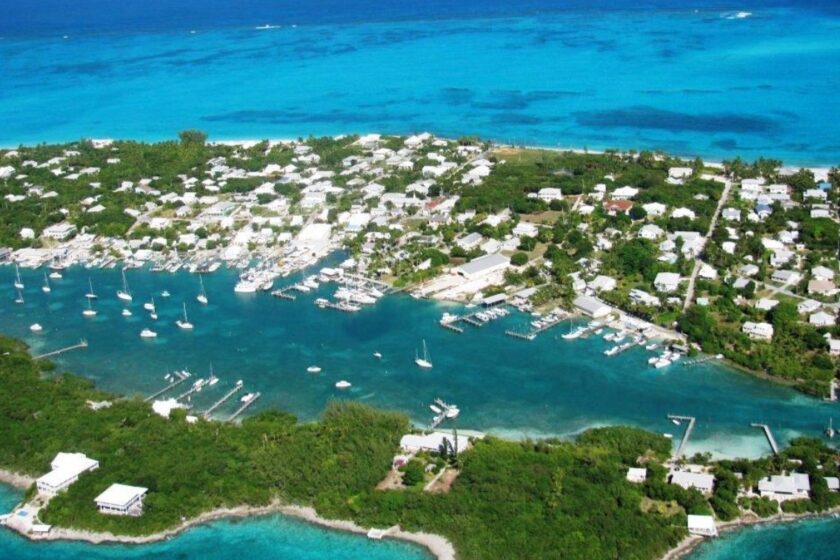
The Abacos had a pre-Hurricane Dorian population of 17,000. Its biggest town is Marsh Harbour, the commercial center of the Abacos. To the east of the mainland of Great Abaco and Little Abaco lie a chain of beautiful small cays running north-south for 120 miles whose eastern shore fronts the deep Atlantic Ocean. Located between this string of cays and the Abaco mainland is the Sea of Abaco, a large, shallow and protected bay that’s a popular cruising ground for boaters. Hopping from one picturesque, historic settlement to the next is but a short cruise by private boat. Green Turtle Cay, Guana Cay, Man-O-War Cay and Hopetown on Elbow Cay are some of the most popular.
Man-O-War was originally settled by Loyalists in 1798. In 1820 a shipwrecked sailor, Benjamin Albury landed on Man-O-War and today his descendants make up most of the 300 residents of the island. For two centuries the Alburys specialized in building fine quality commercial boats made from native woods. Through the years, they continued their boat building tradition. The Albury Brothers runabout boat is still made in Man-O-War, though today it’s hand built of fiberglass and is renowned for its handsome lines and sea kindliness.
As Hurricane Dorian approached, most of Man-O-War’s families had already evacuated by boats to Marsh Harbour, less than an hour’s ride across the Sea of Abaco.
A few of Man-O-War’s residents remained, hold up in a strongly built stone church, on a small hill on the low lying, rocky cay. After all, the residents of the Abacos, like Bahamians throughout the country, had for generations braved many powerful hurricanes. They were well prepared and confident, knew how to shutter their modest but strongly built wooden and concrete block homes, secure their boats with extra lines and anchors, rely on the fresh water that had accumulated in barrels from rainfall and wait and pray for protection by the Almighty while the winds howled and waves crashed. They had always made it through the storms with the determination and unshakable faith of self-reliant islanders. After the storms passed, they went about repairing and rebuilding with a sunny optimism and acceptance of the capricious moods of the sea and sky.
Hurricane Dorian was different.
Its fury could never have been imagined. No one alive had experienced a storm as vicious and merciless as Dorian. The storm surge with giant waves crashed completely over Man-O-War, crushing everything in its path, homes, trees and boats, large and small. Even the rock church where several brave souls sought protection, was being ravaged by the ruthless storm. How would they survive as the roof was battered by the terrible winds and waves crashed through the church windows? Miraculously no one in Man-0-War lost their life.
The string of small Abaco cays bore the brunt of Dorian’s might. Little remained standing on the small islands.
Next in its path was Great Abaco and its largest settlement, Marsh Harbour. Gusts up to 225 miles per hour ripped apart everything in its path. Families huddled in their homes. As the water rose and filled the houses, furniture and washing machines sloshed about like toys. Little children were lifted up inside the roof rafters by desperate parents to escape drowning in the rushing water below. And still the wind shrieked and howled. Roofs were blown off and those lucky enough to get out, ran through the madness holding children, looking for any structure that remained standing. Many failed to make it to safety and were never seen again. The winds and tides carried them quickly away. For those whose roofs stayed attached to their homes and the water rose, overtaking them in the attics, they broke holes through the roof and escaped out, pulling their loved ones with them. Many could not escape and drowned in the rising water.
After flattening Marsh Harbour and the other towns on Great Abaco, Dorian marched ever so slowly across the shallow sound. Its next victim would be Grand Bahama Island and its largest town, Freeport. Its slow forward speed of 1 mph allowed the hovering storm to inflict even more destruction. Aerial shots of first responders to Marsh Harbour and the towns on Grand Bahama showed only piles of rubble and splintered wood where homes and neighborhoods once stood. The trees that survived upright were stripped of vegetation – just miles of hideous black sticks where handsome lush forests once stood.
It took two days for Dorian to make its slow, demonic march across Grand Bahama, finally reaching Freeport toward the western end of the island, flooding and destroying everything in its path.
When Dorian finally departed Grand Bahama and turned north, traveling offshore of the Florida coast, the crews of the few rescue and recovery ships and helicopters that arrived in Abaco and Freeport were shocked by the total annihilation they witnessed. Those who survived, walked about dazed, disoriented, searching for loved ones among bodies that were trapped beneath the debris or floated lifelessly in the high water.
There was nothing left. No shelter from the blazing sun, no water, no food. They asked where was the Royal Bahamas Defense Force boats; where was the police? Who would provide desperately needed emergency help? Security?
The electric generating plants and power distribution grids were destroyed. Fresh water well fields on the north side of Grand Bahama were contaminated by salt water. On the eastern end of the island, oil from damaged and leaking petroleum storage tanks was everywhere. The Pan American Health Organization said the risk of water-borne disease was high. Roads were flooded and blocked with hurricane debris. There were no cleanup crews. Nobody could say when help would arrive. After waiting outside for days at the docks, about five thousand made it to Nassau on ferry boats that had dropped off cargoes of emergency supplies on Grand Bahama. A cruise ship transported 1,500 who could prove U.S. residency to Palm Beach.
Many Bahamians have families in Florida and other states where they could seek temporary refuge. Members of Congress wrote to Secretary of State Mike Pompeo pleading for a temporary relaxation of U.S. visa requirements for the desperate hurricane survivors. The Trump administration refused. More than 60,000 remain on Abaco and Grand Bahama. They are homeless and getting more desperate each day. Within a week, more than fifty were confirmed dead and more than 1,300 are still missing. The Abaco shanty towns of Mudd and Pigeon Peas, where many Haitian families lived, were especially hard hit. Prime Minister Hubert Minnis warned that the death toll could be much higher.
Is climate change, the heating of the atmosphere and the oceans, creating dangerous superstorms such as Dorian?
Dorian is the fifth category 5 hurricane (winds above 157 MPH) in the Atlantic during the last four years and one of only 35 during the last century. Hurricanes are born in or near a tropical ocean. If the ocean water is more than 80 F degrees and atmospheric conditions support high moisture and uniform winds, a tropical cyclone can develop. The hotter the ocean, the more energy is available to fuel the birth of a tropical cyclone. Jeff Beradelli at Yale Climate Connections, wrote that for every one-degree Celsius rise in temperature of the atmosphere from global warming, there is a 40% increase in category 4 and 5 storms.
Since pre industrial times, the average global temperature has risen 1 C degree. Increased temperatures in the oceans and land have not been uniform. Many areas of the globe have seen an even greater increase in temperatures above 2 C degrees. Ninety-three percent of human-caused atmospheric warming caused by greenhouse gas emissions, are absorbed into the oceans. If this excess heat was not absorbed into the oceans, temperatures on Earth would be 90 F degrees hotter, making the planet uninhabitable for animals and plants. The oceans are on average .3 F degrees hotter since pre industrial times according the IPCC. The heat extends down to 2,300 feet where most sea life thrives.
According to the IPCC 2012 report, Since 1975 there has been a substantial and observable regional and global increase in Category 4 and 5 hurricanes, of 25%-30% per Centigrade increase of anthropogenic global warming.
As the atmospheric temperatures rise from climate change, the warmer air holds more water vapor. According to NOAA researcher Jim Kossin, for every Celsius degree rise, there is 7% more water vapor held in the atmosphere. The greater moisture in a storm, the greater the deluge. Dorian flooded Grand Bahama with 30 inches of rain. This greater moisture-holding characteristic will cause not only more rainfall in a storm but an increase in the rate of rainfall, a devastating characteristic causing severe flooding. Kossin wrote that, Added heat in the oceans allows storms to have higher intensities. The stronger storms are more frequent. The strong storms are getting even stronger.
Hurricanes are low pressure systems and when they hover above the oceans, the low pressure causes much higher tides and flooding. During the last 150 years, the oceans have risen about 8 inches from human-caused global warming. Seventy percent of sea level rise is from the melting of the Earth’s great ice sheets on continents and Greenland and Antarctica. The other 30% of sea level rise is from increased heat of ocean water causing it to expand.
The low lying, flat limestone islands in the Bahamas average only three to six feet in elevation above sea level. The highest elevation is 206 feet at Cat Island. Starting with an 8-inch increase in sea level from global warming, then adding super high tides from the low pressure of powerful storms and 185 mph steady winds, Dorian’s storm surge was up to 23 feet high. Bahamians described water rushing into second floor windows.
Climate change has multiplied the power and destructive capacity of storms like Dorian. Half of the fatalities from hurricanes are from storm surge. Climate change has increased sea levels almost one foot. As more powerful storms increase storm surge, low lying countries like the Bahamas are all the more vulnerable.
A powerful hurricane can lose wind speed when crossing land. But when it re-enters the open ocean, increased ocean temperatures from climate change can cause a rapid intensification. It can recover its status as a dangerous category 4 or 5 hurricane.
Dorian moved painfully slow across Abaco and Grand Bahama, only 1 mph forward speed – more time to weaken structures and drenching with more rain. Hurricanes are steered by upper level wind currents. The planet’s belts of atmospheric winds are slowing in speed and that causes hurricanes to move along their path slower. The atmosphere’s winds are caused by differences in heat and pressure between two locations. The temperatures toward the poles are heating at a rate much higher than mid latitudes and consequently there are less temperature and pressure differences between locations at higher and lower latitudes. This causes a decrease in speed of global wind currents and slower moving and therefore more destructive hurricanes like Dorian.
Dorian’s speed of 185 to 225 mph was devastating to the Bahamas. It could be classified as a new, unheard of category 6 hurricane on the Saffir-Simpson scale. It is one of the new and more frequent super storms caused by climate change.